

With forecasters calling for at least the northern Outer Banks and northeastern N.C. to get a blast of wintry weather heading into the weekend, local schools have cancelled classes Friday, the N.C. Ferry Service has called off early morning runs and there are already other closings and delays.


Dare County Schools will be closed Friday for all staff and students. High school students are reminded that any exam scheduled for Friday, January 21 will now be given on Wednesday, January 26. Contact your teacher for more information.
Currituck County Schools will be closed to students Friday, with staff on option 1.
The North Carolina Ferry System is canceling all ferry departures scheduled for Friday before 7 a.m. to allow ferry and road crews to assess travel conditions on a route-by-route basis.
Each individual ferry terminal will then decide whether it is safe to operate the remainder of the day. Passengers wishing to travel on any ferry route over the weekend should check their route’s Twitter feed or call the terminal before heading to the ferry.

Cedar Island-Ocracoke: @NCFerryPamSound, (252) 463-7040
Swan Quarter-Ocracoke: @NCFerryPamSound, (252) 791-3300
Bayview-Aurora: @NCFerryPamRiver, (252) 964-4521
Hatteras-Ocracoke: @NCFerryHatteras, (252) 996-6000
Currituck-Knotts Island: @NCFerryCTuck, (252) 621-6300
For real-time travel information, visit DriveNC.gov or follow NCDOT on social media.
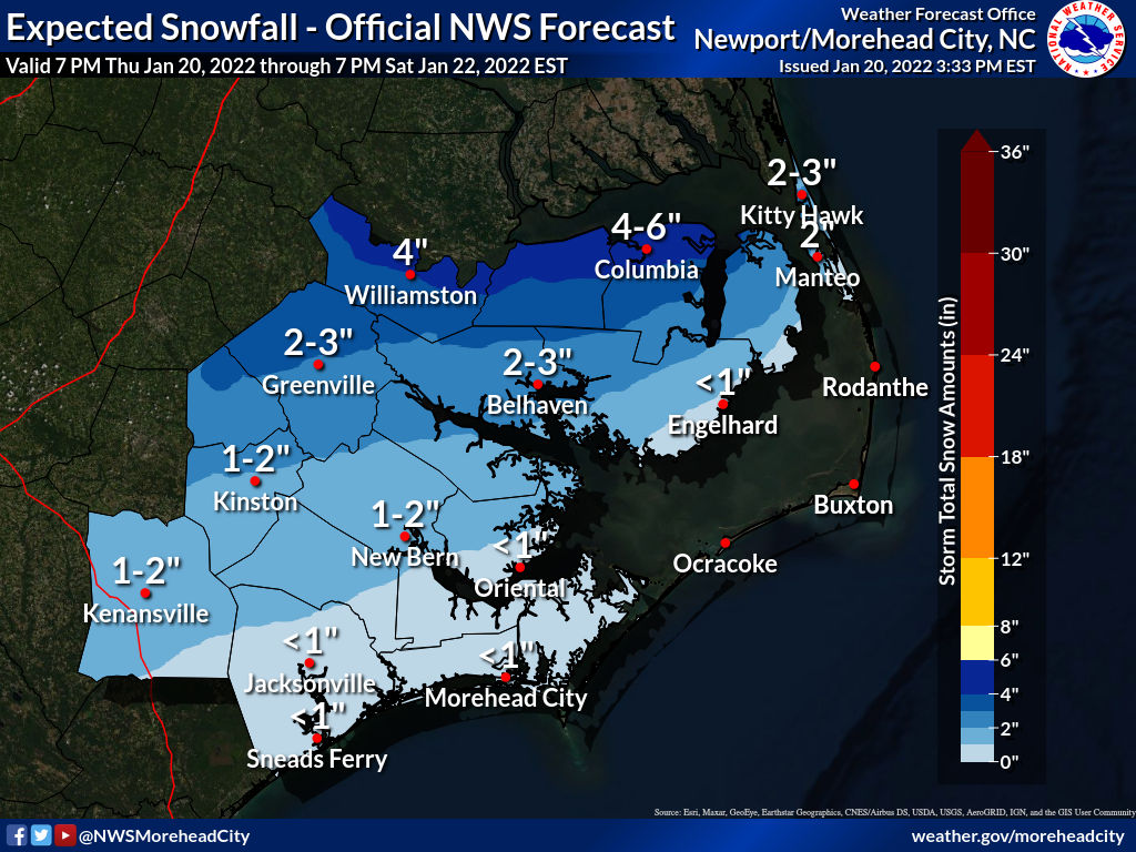
Winter storm conditions arrive early Friday on the mainland, later in the day on Outer Banks
Its a complex scenario across our coverage area, with the highest amount of snow and sleet expected to the closer you get to the state line. Mainland areas are more likely to get the most snow accumulation, but the northern beaches could also see several inches of at least a slushy mix by Saturday morning.
A Winter Storm Warning has been posted for the beaches north of Oregon Inlet and all areas of northeastern N.C. west of the sounds.
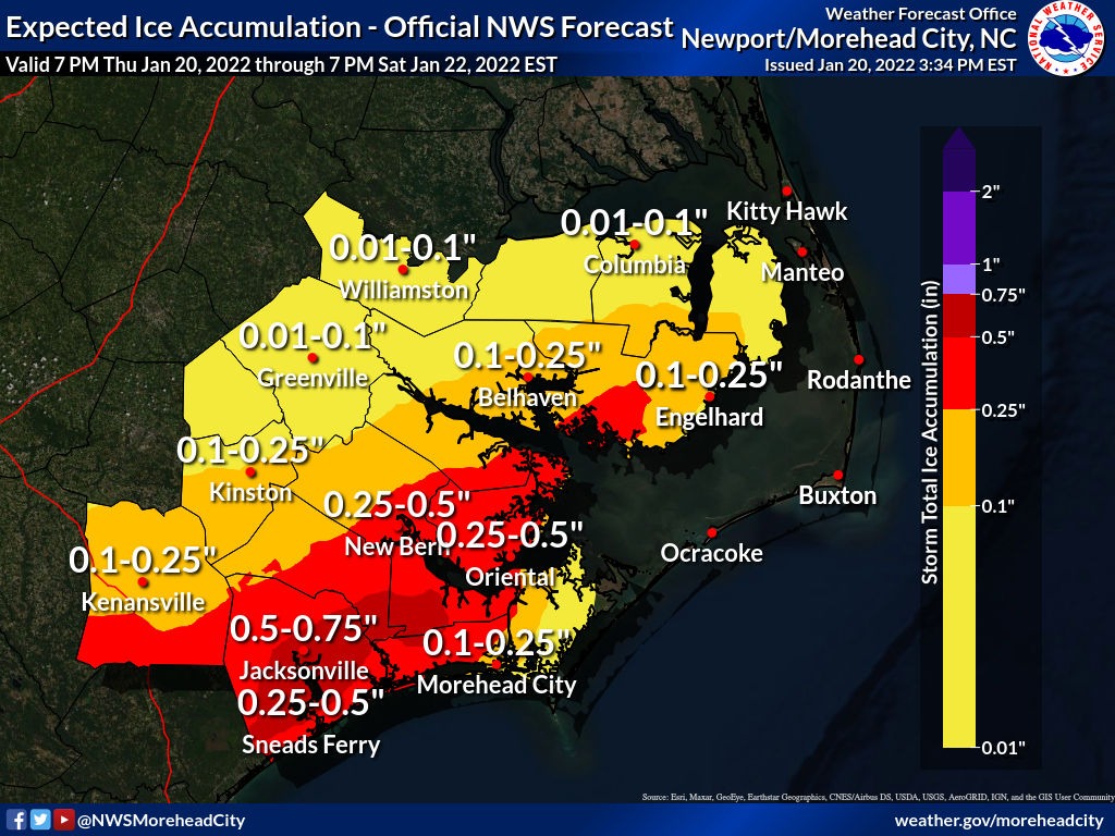
There is also the possibility of minor soundside flooding from Buxton to Ocracoke and minor overwash at high tide along the east facing beaches, due to northerly winds of 25 to 40 mph and higher gusts. A Wind Advisory has been issued for the Outer Banks, along with a High Surf Advisory and Coastal Flood Advisory.
National Weather Service forecast of conditions from Thursday night through Saturday morning:
Thursday afternoon video briefing from the National Weather Service Newport/Morehead City:
Stay with the OBX Today Weather Center, Beach 104, Big 94.5 WCMS, 99.1 The Sound and Z 92.3 for all the latest info.