

A strong cold front moving across the region on Saturday will have the potential to bring severe weather, high winds, minor coastal flooding through the afternoon. And don’t be surprised if there are few snowflakes in the air after the front passes.


The Newport/Morehead City office of the National Weather Service has issued a Wind Advisory for mainland areas, and a High Wind Warning for the Outer Banks from Duck to Ocracoke.
Sustained southwest winds of 20 to 30 mph with gusts to 50 mph are forecast north of Oregon Inlet into the afteroon on Saturday. On Hatteras and Ocracoke islands, winds of 30 to 40 mph with gusts around 60 mph are possible.
The winds will shift to the northwest in the late afternoon as the front moves through and remain in the 20 to 30 mph range, with gusts to 40 mph, through Saturday night.

A level 3/enhanced severe weather threat is forecast for northeast North Carolina and the Outer Banks, with more numerous thunderstorms capable of producing damaging wind gusts that could produce an isolated tornado between noon and 3 p.m.
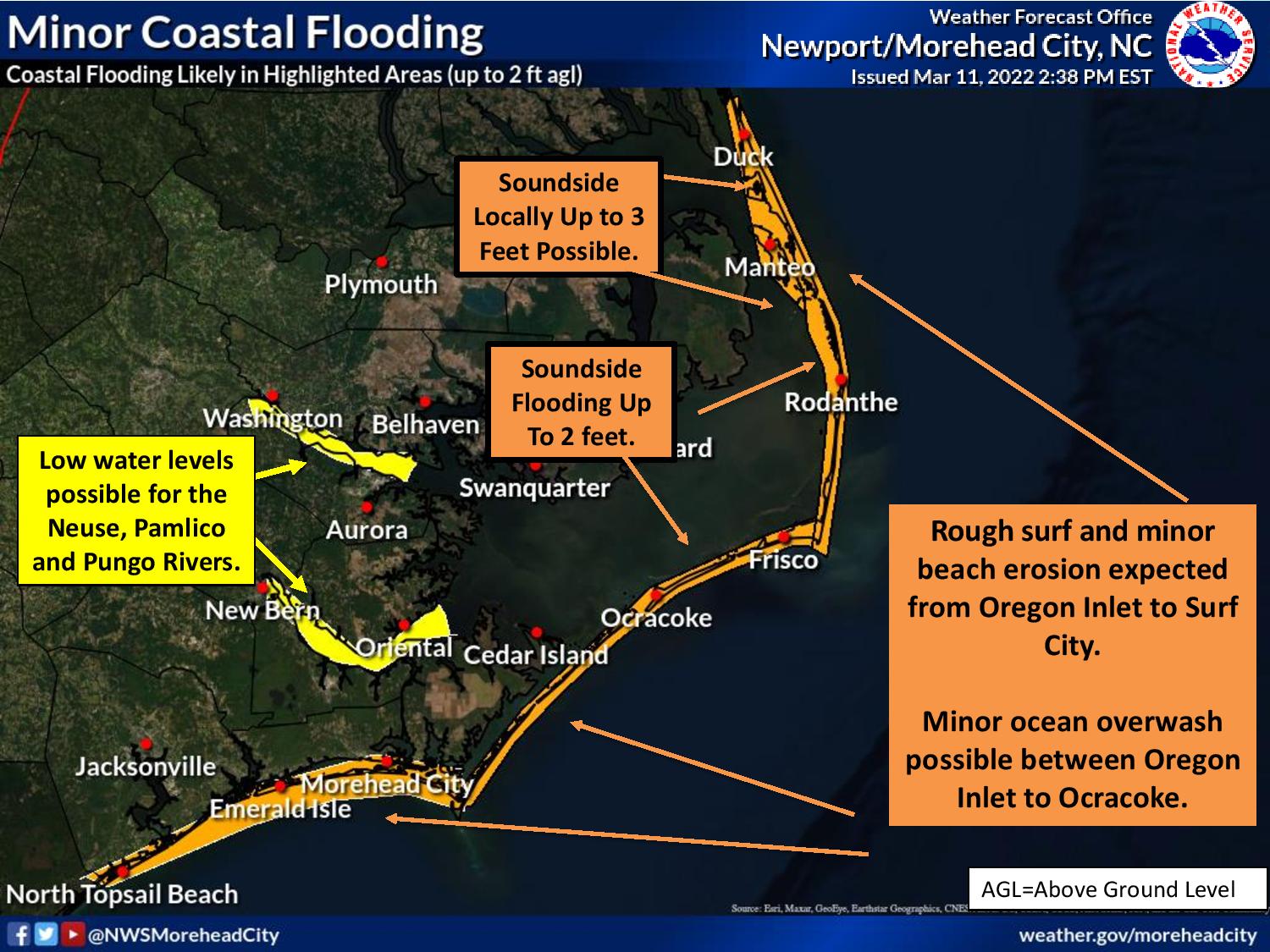
Minor flooding is possible of 2 feet above ground level, especially in the normal trouble spots soundside of the Outer Banks, is possible Saturday morning through Saturday evening. Some locations north of Oregon Inlet could get 3 feet of water above ground level.
Some ocean overwash is possible at high tide along the beaches from Oregon Inlet to Ocracoke, with minor erosion as well.
A Storm Warning is in effect for the Atlantic Ocean south of Oregon Inlet and the Pamlico Sound, while a Gale Warning is in effect for the rest of the coastal waters.
After the front passes, temperatures will plummet and precipitation may change over to snow before tapering off but no accumulation is expected due to the warm ground.
There is the possibility of some black ice forming on bridges and roadways, especially inland where temperatures will drop to near 20 degrees.
Then Sunday morning will start out brutally cold, with temps in the mid 20s and winds of 20 to 30 mph that will have wind chills in the mid teens.
National Weather Service forecast for Nags Head, as of Friday evening: