Wee bit of a blow on Outer Banks, record high temps possible Saturday
December 10, 2021OBX TodayComments Off on Wee bit of a blow on Outer Banks, record high temps possible Saturday
Clouds and a few passing light showers moved across the Outer Banks on Friday. [courtesy SurfChex.com]
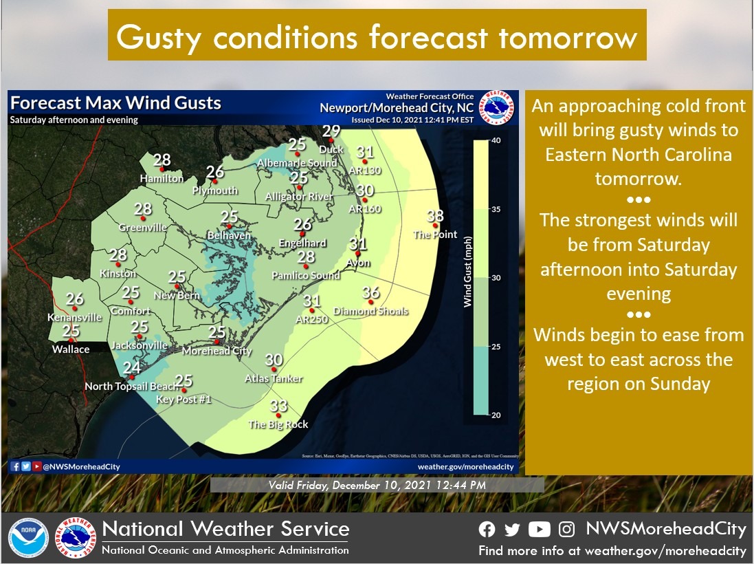
An approaching cold front will bring gusty winds to eastern North Carolina and some inland locations may hit record high temperatures on Saturday before showers and thunderstorms move through overnight and we get back to more seasonable conditions.
There will be a small threat of a few coastal showers and showers could sneak into the coastal plain toward evening ahead of the front, according to forecasters at the Newport/Morehead City office of the National Weather Service.
Complicating the forecast Saturday will be the potential for coastal sea fog as warm, moist air moves across the now cool shelf waters. Areas inland should be able to warm well into 70s, but the beaches may stay in the 60s if that sea fog develops.
The record high at Cape Hatteras for December 11 of 71 degrees was set just one year ago. Elizabeth City’s record high is 76, which has stood since 1971.
Once the front passes early Sunday, dry and seasonably cool weather expected for early next week as surface high pressure prevails across the area.
National Weather Service forecast for Nags Head, as of Friday, 2:30 p.m.:
A slight chance of showers. Mostly cloudy, with a low around 58. South wind 8 to 11 mph, with gusts as high as 15 mph. Chance of precipitation is 20%.
Partly sunny, with a high near 71. Breezy, with a south wind 13 to 21 mph, with gusts as high as 31 mph.
Saturday Night
A chance of showers and thunderstorms before 1am, then showers and possibly a thunderstorm between 1am and 4am, then showers after 4am. Low around 47. Breezy, with a south wind 17 to 22 mph becoming west after midnight. Winds could gust as high as 32 mph. Chance of precipitation is 80%. New rainfall amounts between a tenth and quarter of an inch, except higher amounts possible in thunderstorms.
A chance of showers before 10am. Mostly sunny, with a high near 53. Breezy, with a north wind 17 to 23 mph, with gusts as high as 34 mph. Chance of precipitation is 30%. New precipitation amounts between a tenth and quarter of an inch possible.