

The powerful coastal storm slowly churning up the Atlantic has been buffeting the Outer Banks with fierce northeast winds on Saturday, but there have been no major overwash issues reported with this morning’s high tide.

High wind, high surf and coastal flooding warnings remain in effect from the nor’easter centered off the Georgia coast as it takes makes a slow trek following the Gulf Stream through Monday.
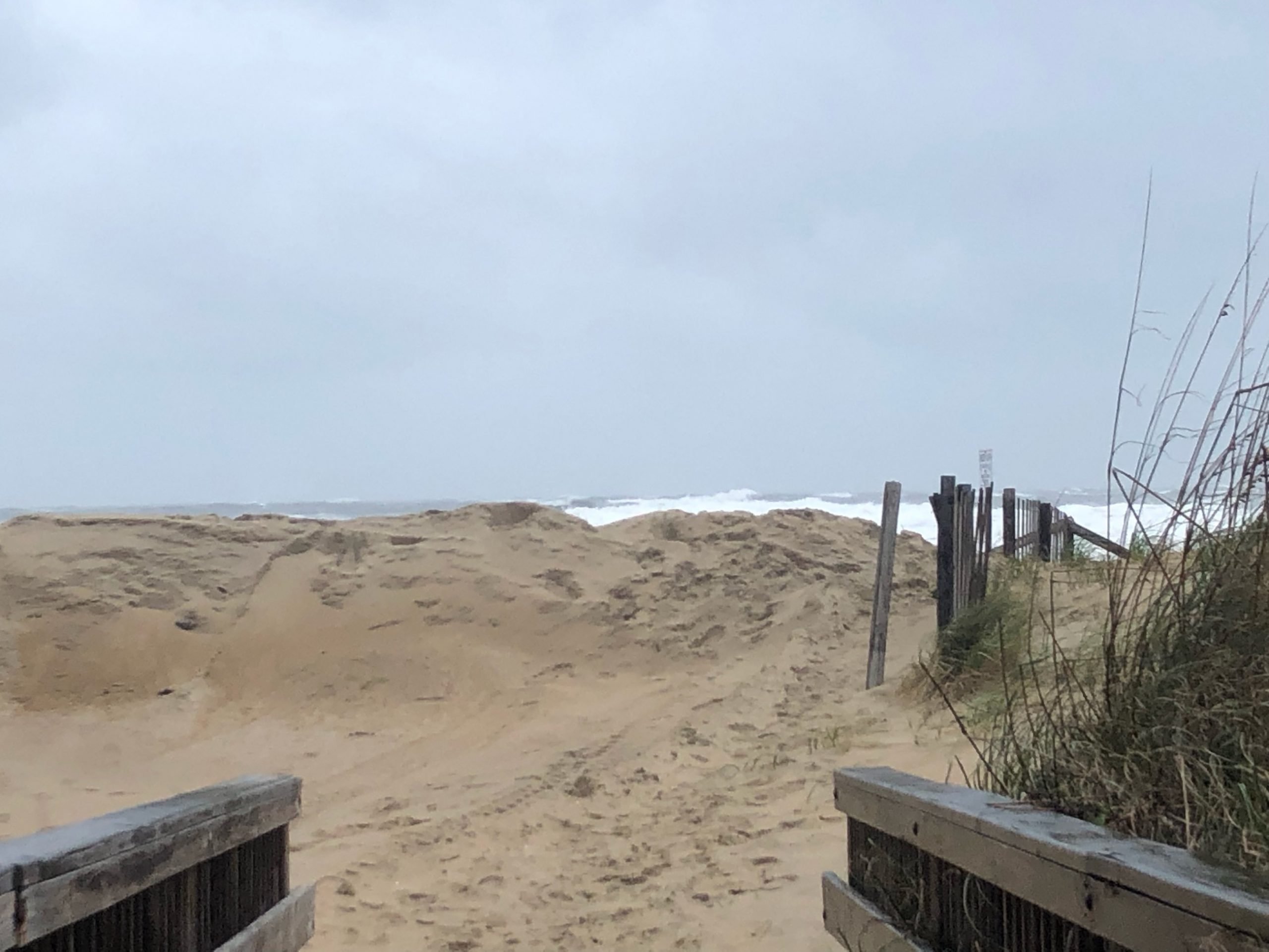
Some overwash was seen at Mirlo Beach in Rodanthe and in the village of Avon, and there was standing water along Ocean View Drive in Avon around midday Saturday.

The main travel issue on N.C. 12 on Hatteras Island has been the sand blown about by winds topping 40 mph.
This morning, crews with the N.C. Department of Transportation have been using front-end loaders and other equipment to clear sand that has blown onto N.C. 12 on the northern part of Hatteras Island in the Pea Island National Wildlife Refuge.
Hey, folks on the North Carolina OBX, be safe. Never drive through flooded roads and be careful. NCDOT crews are working hard to clear sand from NC 12 but things could get worse before they get better. https://t.co/7DXF9Zq8Uy pic.twitter.com/KV5CapPtqc
— NCDOT NC12 (@NCDOT_NC12) November 16, 2019
With the forecast of storm-force winds and offshore waves in excess of 15 feet to continue through Sunday, there is a strong likelihood of N.C. 12 being covered by sand and water with the next several high tide cycles.
Dare County Emergency Management advises everyone to avoid travel as conditions worsen.
“Water, sand and debris can quickly accumulate on roadways causing unsafe conditions,” according to a statement issued Saturday morning.
High tide on Saturday night is around 10:30 p.m., and then 11 a.m. and 11 p.m. on Sunday.
Along the northern beach towns, wind and waves have increased through the day, but there were no dune breeches or overwash so far.
https://www.instagram.com/p/B476_TJAeb6/?utm_source=ig_web_button_share_sheet
All ferry routes to and from Ocracoke, and the Currituck Sound route, were shutdown on Saturday due to the winds and waves.
Bridges in the region remain open to traffic, despite some rumors circulating on social media.
With sustained winds of over 40 mph, and gusts up to 60 mph, expected to last through Sunday, Dominion Energy, Cape Hatteras Electric Co-op and Tideland EMC have crews staged in key locations to address possible power outages.
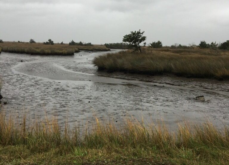
There is the possibility of soundside flooding from Buxton to Ocracoke, with 2 to 4 foot water rises possible along the southern Pamlico Sound.
Ocracoke residents have said so far that they have seen no soundside flooding yet, and just a few of the normal spots had standing water from moderate-to-heavy rainfall experienced on Friday and early Saturday.
While the wind has blown out the sound water on the backside of the northern beaches, don’t expect it to rush back in as winds will remain out of a northerly direction and slowly subside over the next several days.
Earlier this morning, we talked with Reynolds Wolf of The Weather Channel about what we are expecting from the latest nor’easter:
[embedded content]
This story originally appeared on OBXToday.com. Read More local stories here.
Be the first to comment