

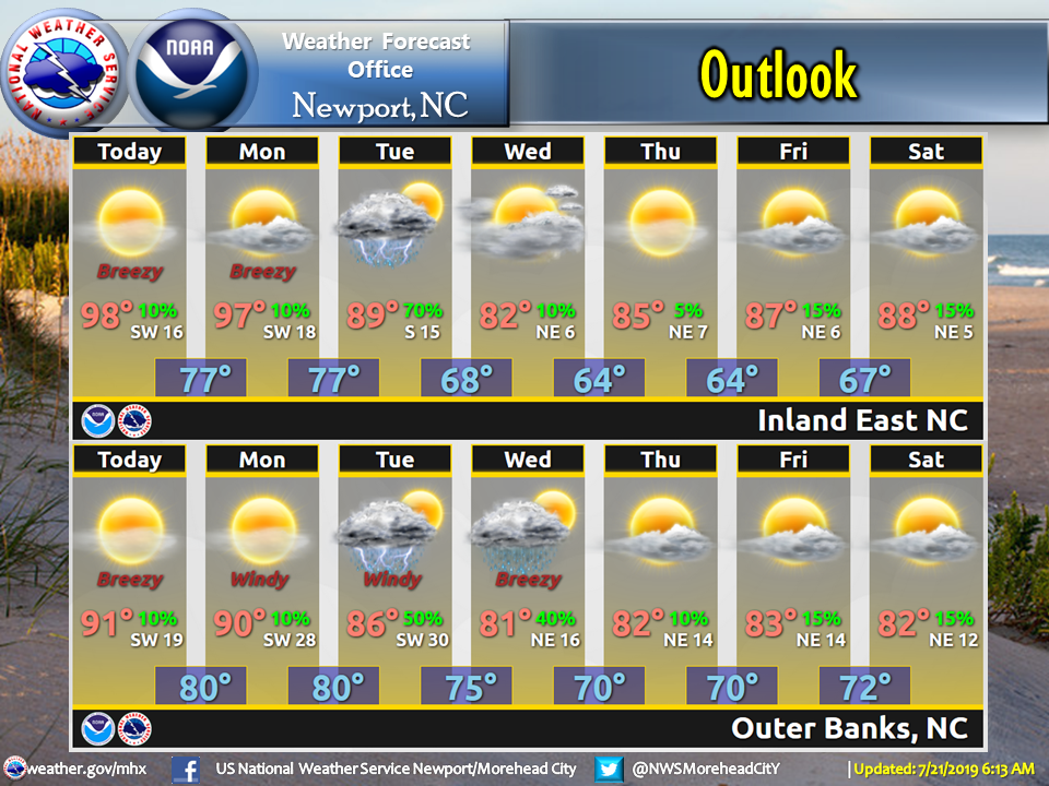
After more than a week of intense heat and humidity, the Outer Banks and northeastern North Carolina will finally catch a break from the steamy weather.

But there’s a bit of tropical activity off the Bahamas that requires watching for signs of development.
An excessive heat warning was posted again for the northern beaches and inland areas on Sunday, with high temperatures well into the 90s and heat indices reaching 105 to 115 in the afternoon.
A heat advisory remains in effect for Hatteras and Oracoke islands, where the heat index was 100 to 110.
Monday is expected to not be quite as hot, although the heat index will still be in the 100s and a heat advisory is expected. Then a cold front slowly moves into the region starting Tuesday.
Isolated to scattered strong thunderstorms are possible beginning late Monday evening, with locally heavy rain possible. Once the front passes, near normal weather conditions are expected for the second half of the week.
Meanwhile, a weak area of low pressure just to the east of the Central Bahamas is producing some disorganized showers and a few thunderstorms.
The National Hurricane Center says some slight development is possible over the next few days, but chances of the disturbance becoming a tropical cyclone are just 10 percent over the next 48 hours, and only 20 percent in the next five days.

This story originally appeared on OBXToday.com. Read More local stories here.
Be the first to comment